-

by
Joe Lombardi
Weather
Updated story - Huge Hurricane Larry Starting To Make Its Move: Latest Projected PathForecasters are watching powerful Hurricane Larry churning in the Atlantic Basin, warning it could wind up being an even stronger storm than Ida, which left a trail of destruction through multiple states.The latest projected track for the Category 3 storm, packed with 115 mile-per-hour winds, still ...
-

by
Jerry DeMarco
Breaking News
Hurricane Larry is making waves -- big ones -- as he spins his way up the Atlantic, but it's still highly doubtful he'll come close enough to do any serious damage to the East Coast, the National Weather Service repeated Monday.Doubling down on its predictions of the Labor Day weekend, the service said the worst we could see in our area are "significant swells" in the Atlantic.These ...
-
by
Joe Lombardi
Weather
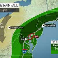
Ida, now a tropical depression, is sweeping toward the Northeast with periods of heavy rain, gusty winds, flash flooding expected in the region with isolated tornadoes possible.Ida is moving through the central Appalachians as it heads northward, with an enhanced risk of tornadoes across parts of the mid-Atlantic on Wednesday, Sept. 1.Significant and life-threatening flash flooding is ...
-

by
Joe Lombardi
Breaking News
Two months into the 2021 Atlantic Hurricane season, the National Oceanic and Atmospheric Administration (NOAA) is now saying it's going to be even more active than initially predicted.On Wednesday, Aug. 4, NOAA scientists updated their original hurricane season forecast, which was released on Thursday, May 20.NOAA forecasters have updated their Atlantic prediction to 15 to 21 named ...
-

by
Joe Lombardi
Weather
We could be in for another active hurricane season, according to the first forecast for 2021.A total of 17 named storms, eight hurricanes, and four major hurricanes are predicted to develop in 2021, according to the Department of Atmospheric Science at Colorado State University.The 2021 hurricane season is now exhibiting characteristics similar to 1996, 2001, 2008, 2011, and 2017, said ...
-

by
Joe Lombardi
Weather
A winterlike storm that is dumping snow and ice in the Rockies and parts of the Midwest will combine forces with the remnants of Tropical Storm Zeta to bring heavy rain and gusty winds to the region as well as snowfall in some spots in the Northeast.The time frame for the merging storms is Thursday afternoon, Oct. 29 into Friday, Oct. 30."The setup for the Northeast will involve a fresh ...
-

by
Joe Lombardi
Weather
Hurricane Teddy's latest projected path takes the center of the storm well east of the region, but it will still be felt in parts of the area.Minor to moderate coastal flooding (from half a foot to 2 feet of inundation depending on location) is expected at the times of high tide through Sunday afternoon, Sept. 20.Additionally, high surf of 8 to 12 feet and dangerous rip currents at ...
-

by
Joe Lombardi
Weather
Get ready for Alpha. Maybe even Beta.With so many storms forming in the Atlantic, the 26-letter English alphabet may not be enough to name them all. In which case, it's on to the Greek alphabet.The storm area residents should most be aware of is Teddy, which has just been upgraded to hurricane status.It's a Category 2 storm as it moves toward Bermuda before continuing toward northern ...
-

by
Joe Lombardi
Weather
As slow-moving Tropical Storm Sally makes its way into the Gulf Coast with landfall expected in Louisiana early Tuesday morning, Sept. 15, there's a new system in the Atlantic that is expected to become a hurricane by midweek.Tropical Storm Teddy, the fifth active named storm in the Atlantic, now has maximum winds of about 40 miles per hour with higher gusts, but it's expected to ...
-

by
Joe Lombardi
Weather
Two tropical storms, a tropical depression, and three more disturbances are now active in the Atlantic.The National Hurricane Center announced Saturday morning, Sept. 12 that it has issued advisories on Tropical Storm Paulette, Tropical Storm Rene and Tropical Depression 19. (See the first image above.)Paulette, tracking steadily closer to Bermuda, is near hurricane strength. For its ...
-

by
Joe Lombardi
Weather
A new round of scattered, severe thunderstorms will be followed by rainfall from now Tropical Depression Laura on its trek out to sea.Friday, Aug. 28 will be mostly sunny with the high temperature in the mid 80s. Very humid air will create conditions ripe for thunderstorms.Clouds will gradually increase, and there will be spotty showers and thunderstorms in the afternoon and evening.The ...
-
by
Joe Lombardi
Weather
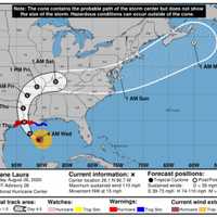
Laura strengthened overnight into a large, "formidable" storm, the National Hurricane Center announced Wednesday morning, Aug. 26.It's expected to become a Category 4 hurricane before making landfall near the Texas/Louisiana border late Wednesday night or early Thursday morning, Aug. 27.A dangerous, "life-threatening storm surge of up to 15 feet" in some places will be accompanied by ...


